 Play/Experience
 eat
eat shopping
 Tourist attractions
 stay
stay Training camp/training
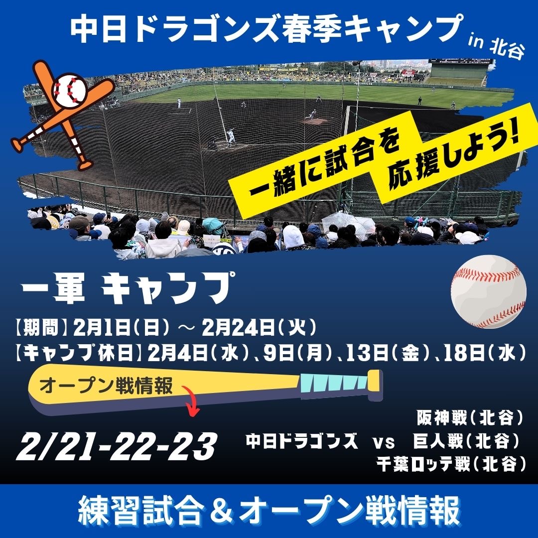
 Chunichi Dragons support
 event
event news
news Chatan brand
 Tourist Guidebook
 access
TOPIC
emergency evacuation
Disaster Preparedness
InformationChatan Town Disaster Prevention Information
If you feel shaking along the coast,
Immediately evacuate to higher ground
Check it out now
Check Now
Chatan Town Online Disaster Prevention Map
You can check the evacuation buildings around your current location.
- Tsunami Disaster Warning Area
- Landslide warning area
- Evacuation shelters and evacuation buildings
Just in case
Save for Offline
Recommended download
Chatan Town Disaster Prevention Map PDF
You can view maps even when there is no signal
We recommend that you download and save it in advance.
Weather and disaster information
Weather & News
Useful Links
Useful Links & Support
Related Links
Available 24 hours a day
Multilingual support in times of disaster
Japan Visitor Hotline
Travel Japan | JNTO
Available in English, Chinese, Korean and Japanese
English, Chinese, Korean,
English